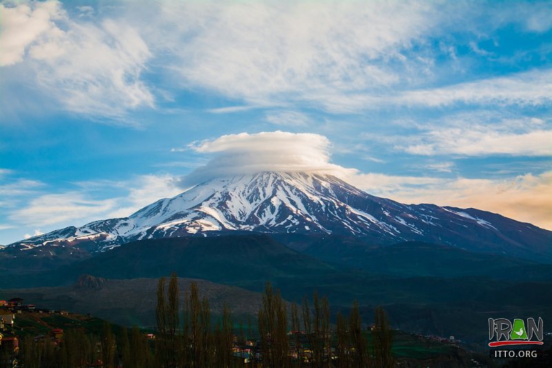
The territory of Iran comprises 1.648 million square kilometres – double the size of neighbouring Turkey and three times the size of France – of which 1.636 million square kilometres is land and 12,000 square kilometres water. Iran is a mountainous country. The Zagros Mountains bisect the country from north-west to south-east. Many peaks in the Zagros exceed 3,000 metres above sea level. Rimming the Caspian Sea are the Alborz Mountains, which are narrow but high.
The volcanic Mount Damavand (5,671 metres), located in the centre of the Alborz, is Iran’s highest peak; on clear days, it can be seen from Tehran. The central portion of Iran is referred to as the Central Plateau. The eastern part of the plateau is covered by two salt deserts, the Dasht-e Kavir (Great Desert) and the Dasht-e Lut (Barren Desert).
State Borders:Iran borders Pakistan, Afghanistan, and Turkmenistan on the east, Iraq on the west, and Turkey, Armenia, Azerbaijan, and the Azerbaijan-Nakhichevan exclave on the north. To its south Iran borders the Gulf of Oman and the Persian Gulf, and to its north the Caspian Sea (the largest lake on earth, with an estimated surface area of 371,000 square kilometres).
The Aras (also known as Araks) River lies along the border with Iran and Azerbaijan. In the Treaty of Turkmenchay (1828) the river was chosen as the border between the Russian and Persian empires. In 1963 Iran and the Soviet Union began construction of the Aras Dam, which was inaugurated in 1971.
Climate:Iran has a variable climate. In the northwest, winters are cold with heavy snowfall and subfreezing temperatures during December and January. Spring and fall are relatively mild, while summers are dry and hot. In the south, winters are mild and the summers are very hot, having average daily temperatures in July exceeding 38 °C (100.4 °F). On the Khuzestan Plain, summer heat is accompanied by high humidity.
In general, Iran has an arid climate in which most of the relatively scant annual precipitation falls from October through April. In most of the country, yearly precipitation averages 250 millimetres (9.8 in) or less. The major exceptions are the higher mountain valleys of the Zagros and the Caspian coastal plain, where precipitation averages at least 500 millimetres (19.7 in) annually. In the western part of the Caspian, rainfall exceeds 1,000 millimetres (39.4 in) annually and is distributed relatively evenly throughout the year. This contrasts with some basins of the Central Plateau that receive ten centimeters or less of precipitation.
Land fertility:Mountain ranges, deserts, and wasteland cover about half of Iran’s total land area. An estimated one-third of the country’s total surface area is suited for agricultural production. Almost 12 percent of Iran’s territory is under cultivation (arable land, orchards, and vineyards), but less than one-third of the cultivated land is irrigated, and the rest is cultivated by dry farming.


