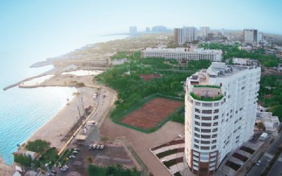
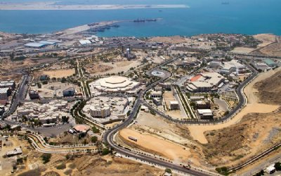
The southern Iranian island of Qeshm, after Kish, which has the most luxurious and developed facilities, is the most popular tourist destination.
The island is home to many natural attractions, historical monuments, recreational facilities, and shopping malls.
Here is a list of places one shouldn’t miss when visiting the island:
The Qeshm Island Geopark, as the sole geopark in West Asia, is a vast area whose borders are clearly defined and within which some remarkable geological phenomena are found such as Namakdan Cave that is one of the longest salt caves in the world. Due to its location on the beautiful Persian Gulf shore and Hara Forest, this geological area has some interesting geological phenomena.
The geopark is one of the most important in terms of geological phenomena and the diversity of phenomena such as ecology, monuments, environment, and wildlife that it enjoys more than any other geopark.
")
Qeshm, because of its geographical location, has long been an important strategic center. The Portuguese conquered and ruled it for about 200 years, so even today, it has an ancient Portuguese fortress and many streets bear Portuguese names.
The fortress was constructed on the island in the 16th century. The stronghold was built upon the orders of Portuguese commander Alfonso de Albuquerque when his forces seized the islands in the early sixteenth century.
The Portuguese also left other military structures on the Iranian islands of Hormuz and Larak and in the port of Kong as legacies of their colonialism in the Persian Gulf.
The Persian–Portuguese war took place from 1507 to 1622 and involved the Portuguese Empire and the Kingdom of Ormus, its vassal, on one side, and the Safavid Persia (Iran) with the help of the Kingdom of England on the other side.
In 1622 when the Persians retook Hormuz and other occupied lands, the Portuguese Empire was one of the largest and most powerful empires in the world.
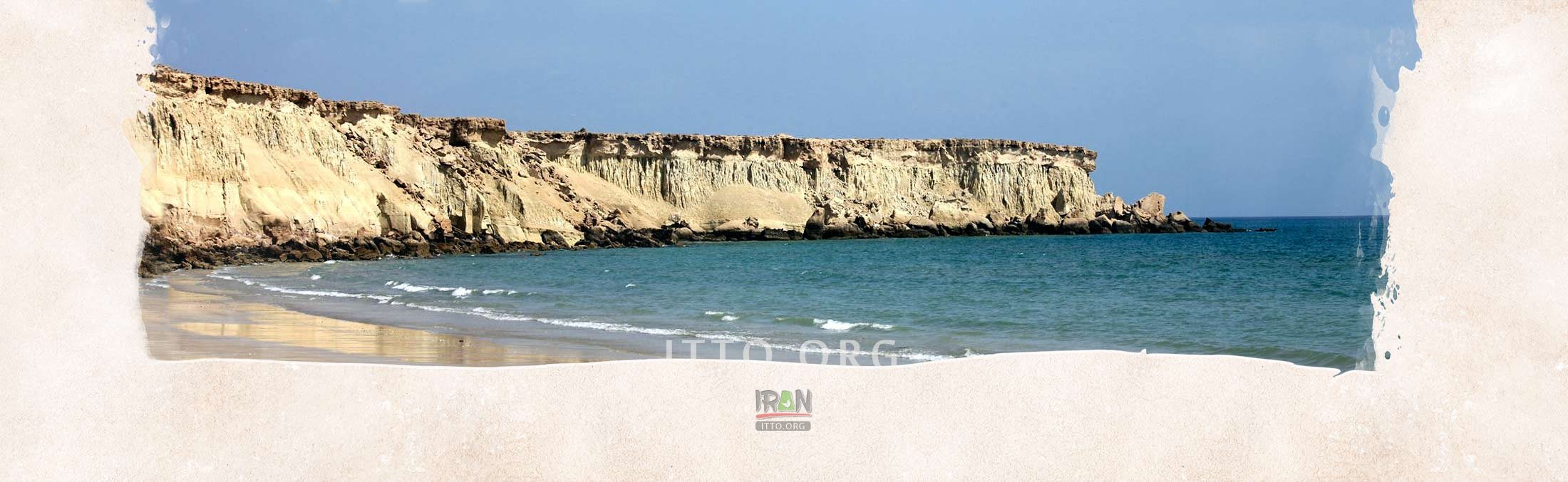
One of the world’s most eye-catching nature’s creativities at its finest, Darreh-ye Tandis-ha is a remnant of a high plateau that has been once connected to the “Roof” of Qeshm. The valley is part of those areas which have been once underneath the water, and when pulled up, it has been heavily eroded by sea waves among other factors.
This type of erosion gets reduced gradually while moving more towards the “Roof” of Qeshm, which has remained intact.
In some areas of the valley, numerous fossils may be found including fossils of bivalves, in some areas as colonies. Another interesting geological phenomenon in the valley is sedimentation forming muddy mud cracks, which has created beautiful and interesting landscapes.
During and after the rainfall, it is important to pay attention to muddy areas where sometimes the mud is very sticky and dangerous to walk on at this geo-site.
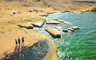
About two million years ago, the Valley of Stars was formed due to soil, stone, and sand erosion caused by the wind, rain, and showers, making the valley a rare natural masterpiece on the Qeshm Island.
According to local legend, a star fell from the sky and hit the ground right in the heart, forming a huge, mysterious, and strange valley that we now know as Stars Valley.
The locals aren’t entirely wrong since scientific investigations revealed that this phenomenon was formed by a cosmic in the first place. Moreover, this valley’s mysterious shapes are a result of water and wind erosions as well.
Although no stars were involved in the formation of Stars Valley, thousands of stars are clearly visible to the naked eye at night, hence the name ‘Valley of Stars’.

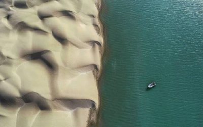
The Hara (Mangrove) forests on Qeshm Island are among the most popular attractions due to their unique and diverse ecology, which appeal to tourists, especially nature lovers.
There are very few tree species that can survive in salty water, such as those of the forest. Because of the abundant salt in the seawater, trees are able to grow along the seafront, and little vegetation can be seen there.
But in the course of their gradual evolution, which has occurred over thousands or even millions of years, these trees have been able to adapt to the saltwater of the sea and have grown to be an important part of the southern seas of Iran.
Because of their importance, many of these trees are protected in these areas. As the mangrove forests are frequently submerged in seawater, these trees must also be able to survive conditions where most of their leaves and roots are underwater.
Aside from the commercial benefits for the locals of this region, this area has become a popular tourist destination, and countless nature lovers stroll through these forests on Qeshm Island.
Different species of birds can often be found in these forests because mangrove forests are a good habitat for birds and other animals.
As part of the Qeshm Island Geopark, Chahkooh Valley, literally meaning a mountain of wells, shows erosion of sedimentary rocks and has a depth of 100 meters.
Chahkooh Valley is famed for its three or four wells in its heart, which have been dug since ancient times by the inhabitants of the nearby villages in order to supply fresh water.
Due to the dry and hot climate on Qeshm Island, freshwater stored in the valley is valuable, and wells have been used to store rainwater.
The valley is surrounded by rock mountains. Initially, Chahkooh’s walls are high and the area appears wide, but gradually the width decreases until it becomes difficult to pass through, but the walls are still high.

In Kharbas Cave, visitors to Qeshm Island enjoy the mysterious world of the cave, which was built by humans in ancient times but its true story is still unclear.
Median tribe - the first Persian tribe - is thought to have built this cave. Natural factors such as declining water levels and human carvings throughout history contributed to the appearance of the cave today. The structure of the cave has changed over time as people’s needs have changed.
The cave rock walls are about 20 to 30 meters high. Kharbas Cave is in fact a collection of four caves. In the Sasanid era, there was a village called Khorbiz or Khorbes that was thriving and prosperous. Kharbas Cave, however, has gained the importance it deserves despite the village being in ruins.
There are some who believe that this cave used to be a place of worship for the Anahita, the Persian goddess of water. Others believe that this cave used to be a temple for followers of Mithraism.
Another theory suggests it was a place where the dead bodies were kept to be eaten by birds, which is a Zoroastrian tradition and belief. According to some others, this cave provided refuge from pirate attacks when the island was attacked.

Namakdan Salt Cave is the longest salt cave in the world, measuring about 6400 meters long. The cave is one of several salt caves in the salt cone-shaped Namakdan mountain.
A view of this mountain from a distance is stunningly beautiful due to the white streaks of salt on its body.
Visitors’ eye-catching views have been created by the cave’s colorful sedimentary layers and white walls. Various minerals and salt deposits have given the cave mouth a colorful appearance. Within each layer lies a part of the earth’s ancient antiquity.
Upon entering the cave and getting further into it, you will see crystalline salt covering the floor. A beautiful white view is created by the stalactites in the cave along with this beautiful flooring. Crystals of pink, purple, blue, and crimson red can also be seen.
It is quite amazing to hear when walking through the cave an unfamiliar crackle sound due to stepping on salt crystals.
A beautiful feature of the cave is the saltwater streams that flow from the bottom. Namakdan Mountain has an underground water flow that runs continuously. This flow opens out of the cave from the heart of the mountain. Saltwater gathers in a natural white pool beneath the mountain that resembles a spring.
There are times when the saltwater in the cave reflects the images and creates a stunning and unique view. The main bed of the spring has a red color and is covered with sediments of red mud.
This cave has a beautiful structure with crystal stalactites that appear to have different shapes on the roof. Seawater drips on the stalactites’ bodies due to the humidity of the air on the island and the infiltration of water in the cave. Because of this, these stalactites are always in the process of forming.

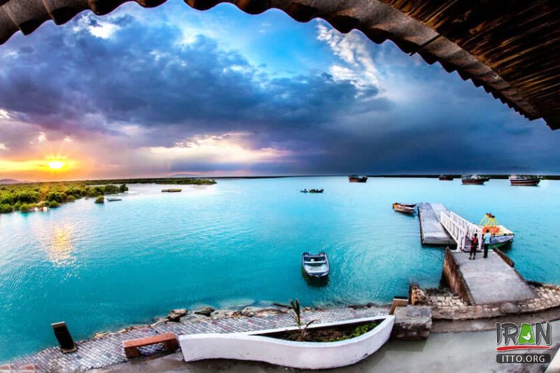
The village of Laft is situated on Qeshm Island next to Hara forest.
Even though Yazd is most commonly associated with badgirs (the ancient Persian windcatchers or wind towers), a structure that provided natural ventilation, a glance at the skyline of this historical port gives the impression of fierce rivalry.
A few Ab-Anbars (cisterns)exist as well and are still used by locals today. The Tala Wells (Golden Wells) are also located in Laft, which were created by cutting holes into layers of stone. In the past, the number of wells was equal to the number of days in a leap year, but now there are fewer than 100, each with its own name.
Several aspects of this village’s architecture are interesting. The most notable feature is the badgirs of different sizes. Moreover, the streets are narrow and the buildings and houses are built very close to each other.
In the village, mosques stand out as the most impressive monuments. In Laft, there are seven mosques, and the residential areas are clustered around the mosques. The main center of the village is the Jameh Mosque of Laft.


 Loading... Please wait


 Please wait